Heading east on Route 66 after Newberry Springs, the historic highway is a frontage road along Interstate 40 once you're past I-40 Exit 23, which is Ft Cady Road. When I drove 66 in November 2011, I had no idea at that time just how rough of a road it gets. I wasn't seeing much in the way of ruins; the interstate was to my left, and being slowed down to 25 mph or so (and then driving on the shoulder since it was smoother!) wasn't much to my liking. When I drove it again with Sheila last July, we got back on I-40 at Ft Cady Road instead of toughing it out to Hector Road, which is Exit 33. The next I-40 exit after that is Ludlow, Exit 50.
Ludlow is still a busy stop for travelers, but it isn't what it used to be. People heading in either direction will tank up at the Chevron station in Ludlow as that services aren't available until you're near Barstow heading west, or Needles if heading east. In front of that Chevron station is Route 66, and I remember taking a long look at it one night back in December 2008, and thinking, so that's it. That's 66. I need to drive that some day.
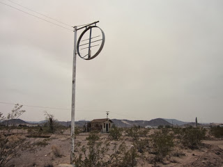
The photos in this posting are of what's left of Ludlow, which declined with the opening of the interstate, but which refuses to fade away.
A historical marker in front of the Ludlow Cafe. You'll need to click on this to get a better look. Photo taken 7/16/13.
A display in front of the Ludlow Cafe, which is on the south side of the street. 7/16/13.
Looking west. You can see my truck at the right edge of the photo. The old truck underneath the overhang of the abandoned station is not in commission. When we got closer, we noticed that the tires were flat on it. 7/16/13.
On the north side of Route 66, there is this abandoned service station that did not survive the advent of I-40. 7/16/13.
A closer view of the same service station, taken on 11/30/11.
Another closeup, from 11/30/11.
Looking northwest or so, 11/30/11.
This structure is adjacent to those of the previous photos. 11/30/11.
This wider view, from 11/30/11, shows yet another structure.
On the south side of Route 66 is this derelict. This was as close as I got. 11/30/11.
Another abandoned structure on the south side of the road that I photographed on 11/30/11.
A different perspective of that same structure from 7/16/13.
From 7/16/13. That's the same relic three pictures above, but from a distance.
I don't know what this was. A small mini-mart? 7/16/13.
And finally, the Route 66 shield as painted on the surface in Ludlow.
At this point US 66 bends south from I-40 to follow its own path; not rejoining for several miles or so. The road surface is much better. There's also not a lot of traffic on this road save for the other 66 enthusiasts that you'll stumble across.
I didn't know it on the 2011 trip, but the best was yet to come.


No comments:
Post a Comment